
- Start >
- Groundwater >
- Waterlevel of upper layer >
- Bayern >
- Endinger Loch >
- Current data

Current data Endinger Loch
Groundwater levels of the last 12 months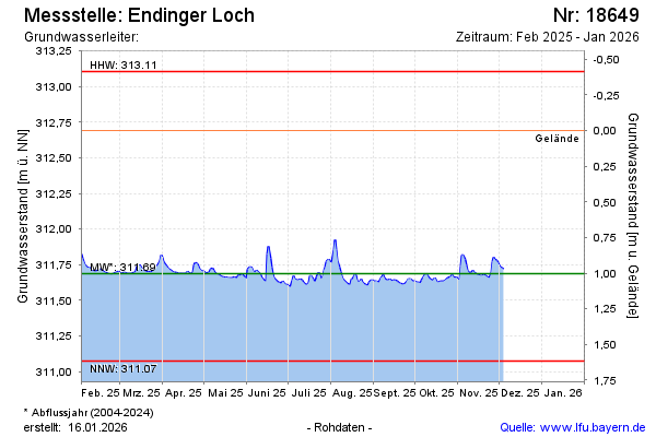
note
GW Messtelle im SN Flussraum Vils
Groundwater level [m above sealevel]: 311.91
Distance to surface [m]: 0.78
Last value from 12.02.2026 15:00
Ground level [m above sealevel]: 312.69
| Date | Groundwater level [m above sealevel] |
|---|---|
| 12.02.2026 | 311.91 |
| 11.02.2026 | 311.90 |
| 10.02.2026 | 311.89 |
| 09.02.2026 | 311.88 |
| 08.02.2026 | 311.79 |
| 07.02.2026 | 311.71 |
| 06.02.2026 | 311.68 |
| 05.02.2026 | 311.68 |
© Bayerisches Landesamt für Umwelt 2026