
- Start >
- Groundwater >
- Waterlevel of upper layer >
- Bayern >
- BK9-Karlstein_Schmalschlägerstr 2 >
- Chart of total period

Chart of total period BK9-Karlstein_Schmalschlägerstr 2
Groundwater levels of the total period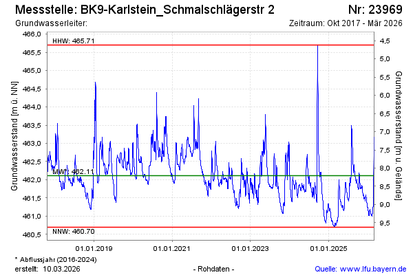
Groundwater level [m above sealevel]: 462.86
Distance to surface [m]: 7.46
Last value from 02.03.2026 13:00
Ground level [m above sealevel]: 470.32
| Date | Groundwater level [m above sealevel] |
|---|---|
| 02.03.2026 | 462.90 |
| 01.03.2026 | 463.00 |
| 28.02.2026 | 463.12 |
| 27.02.2026 | 463.17 |
| 26.02.2026 | 463.07 |
| 25.02.2026 | 462.67 |
| 24.02.2026 | 462.03 |
| 23.02.2026 | 461.70 |
© Bayerisches Landesamt für Umwelt 2026