
- Start >
- Groundwater >
- Waterlevel of upper layer >
- Bayern >
- BK2-Urschlauer Ache >
- Chart of total period

Chart of total period BK2-Urschlauer Ache
Groundwater levels of the total period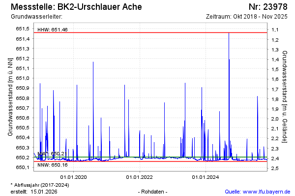
Groundwater level [m above sealevel]: 650.48
Distance to surface [m]: 2.11
Last value from 16.11.2023 12:50
Ground level [m above sealevel]: 652.59
| Date | Groundwater level [m above sealevel] |
|---|---|
| 16.11.2023 | 650.53 |
| 15.11.2023 | 650.69 |
| 14.11.2023 | 650.46 |
| 13.11.2023 | 650.19 |
| 12.11.2023 | 650.18 |
| 11.11.2023 | 650.19 |
| 10.11.2023 | 650.19 |
| 09.11.2023 | 650.19 |
© Bayerisches Landesamt für Umwelt 2024