
- Start >
- Groundwater >
- Waterlevel of upper layer >
- Bayern >
- BK2-Urschlauer Ache >
- Current data

Current data BK2-Urschlauer Ache
Groundwater levels of the last 12 months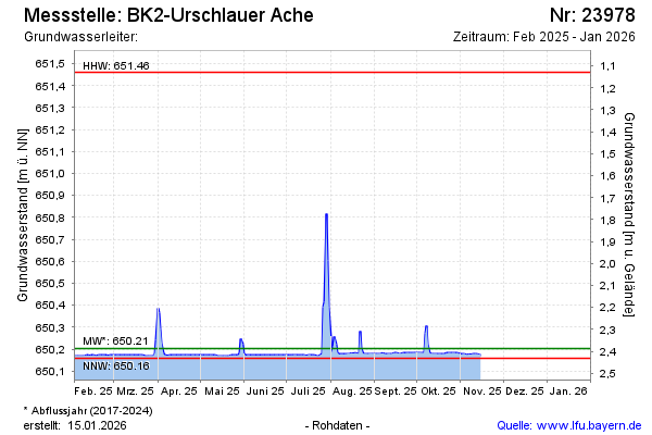
Groundwater level [m above sealevel]: 650.18
Distance to surface [m]: 2.41
Last value from 15.11.2025 11:11
Ground level [m above sealevel]: 652.59
| Date | Groundwater level [m above sealevel] |
|---|---|
| 15.11.2025 | 650.17 |
| 14.11.2025 | 650.18 |
| 13.11.2025 | 650.18 |
| 12.11.2025 | 650.18 |
| 11.11.2025 | 650.18 |
| 10.11.2025 | 650.18 |
| 09.11.2025 | 650.18 |
| 08.11.2025 | 650.17 |
© Bayerisches Landesamt für Umwelt 2026