
- Start >
- Groundwater >
- Waterlevel of upper layer >
- Bayern >
- BK10-Urschlauer Ache >
- Chart of total period

Chart of total period BK10-Urschlauer Ache
Groundwater levels of the total period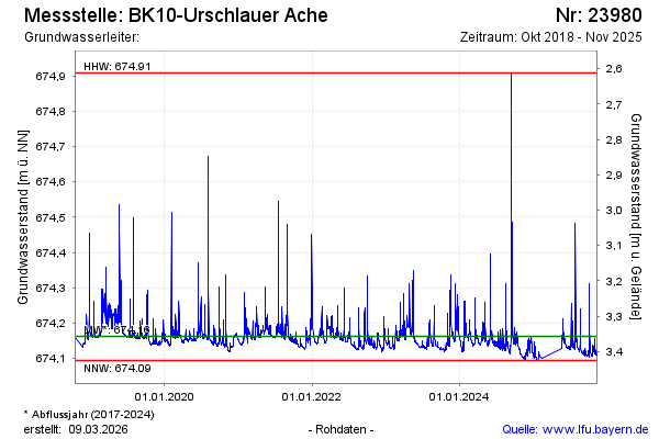
Groundwater level [m above sealevel]: 674.13
Distance to surface [m]: 3.39
Last value from 20.03.2026 10:40
Ground level [m above sealevel]: 677.52
| Date | Groundwater level [m above sealevel] |
|---|---|
| 20.03.2026 | 674.13 |
| 19.03.2026 | 674.13 |
| 18.03.2026 | 674.13 |
| 17.03.2026 | 674.13 |
| 16.03.2026 | 674.13 |
| 15.03.2026 | 674.13 |
| 14.03.2026 | 674.14 |
| 13.03.2026 | 674.14 |
© Bayerisches Landesamt für Umwelt 2026