
- Start >
- Groundwater >
- Waterlevel of upper layer >
- Bayern >
- Birkenfeld WÜ - MU 1 >
- Current data

Current data Birkenfeld WÜ - MU 1
Groundwater levels of the last 12 months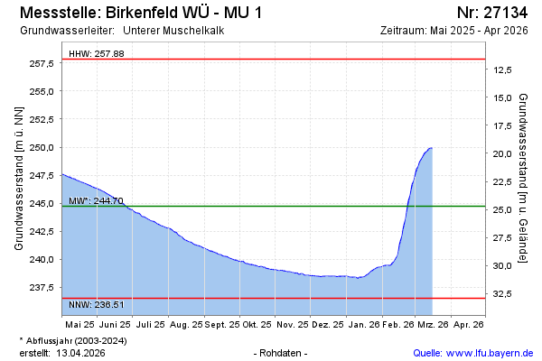
Groundwater level [m above sealevel]: 245.26
Distance to surface [m]: 24.18
Last value from 24.02.2026 15:00
Ground level [m above sealevel]: 269.44
| Date | Groundwater level [m above sealevel] |
|---|---|
| 24.02.2026 | 245.11 |
| 23.02.2026 | 244.71 |
| 22.02.2026 | 244.16 |
| 21.02.2026 | 243.61 |
| 20.02.2026 | 243.05 |
| 19.02.2026 | 242.65 |
| 18.02.2026 | 242.09 |
| 17.02.2026 | 241.63 |
© Bayerisches Landesamt für Umwelt 2026