
- Start >
- Groundwater >
- Waterlevel of upper layer >
- Bayern >
- ADELSRIED TA 1 F >
- Chart of total period

Chart of total period ADELSRIED TA 1 F
Groundwater levels of the total period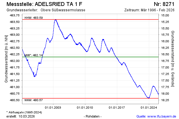
Groundwater level [m above sealevel]: 480.77
Distance to surface [m]: 17.98
Last value from 27.11.2025 13:49
Ground level [m above sealevel]: 498.75
| Date | Groundwater level [m above sealevel] |
|---|---|
| 27.11.2025 | 480.78 |
| 26.11.2025 | 480.78 |
| 25.11.2025 | 480.79 |
| 24.11.2025 | 480.80 |
| 23.11.2025 | 480.79 |
| 22.11.2025 | 480.78 |
| 21.11.2025 | 480.78 |
| 20.11.2025 | 480.79 |
© Bayerisches Landesamt für Umwelt 2025