
- Start >
- Groundwater >
- Waterlevel of upper layer >
- Bayern >
- ADELSRIED TA 1 F >
- Current data

Current data ADELSRIED TA 1 F
Groundwater levels of the last 12 months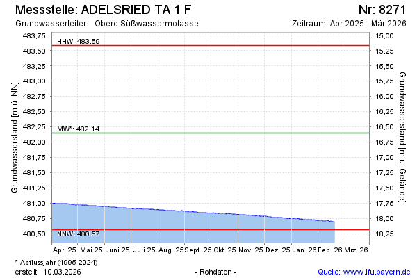
Groundwater level [m above sealevel]: 480.67
Distance to surface [m]: 18.08
Last value from 20.02.2026 10:30
Ground level [m above sealevel]: 498.75
| Date | Groundwater level [m above sealevel] |
|---|---|
| 20.02.2026 | 480.68 |
| 19.02.2026 | 480.69 |
| 18.02.2026 | 480.69 |
| 17.02.2026 | 480.69 |
| 16.02.2026 | 480.70 |
| 15.02.2026 | 480.70 |
| 14.02.2026 | 480.69 |
| 13.02.2026 | 480.70 |
© Bayerisches Landesamt für Umwelt 2026