
- Start >
- Groundwater >
- Waterlevel of deep layer >
- Regnitz >
- Reichelsdorf B 5 >
- Chart of total period

Chart of total period Reichelsdorf B 5
Groundwater levels of the total period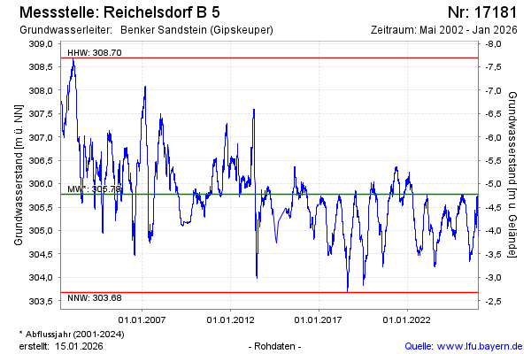
Groundwater level [m above sealevel]: 305.41
Distance to surface [m]: -4.41
Last value from 20.05.2026 09:00
Ground level [m above sealevel]: 301.00
| Date | Groundwater level [m above sealevel] |
|---|---|
| 20.05.2026 | 305.42 |
| 19.05.2026 | 305.43 |
| 18.05.2026 | 305.45 |
| 17.05.2026 | 305.46 |
| 16.05.2026 | 305.49 |
| 15.05.2026 | 305.53 |
| 14.05.2026 | 305.54 |
| 13.05.2026 | 305.54 |
© Bayerisches Landesamt für Umwelt 2026