
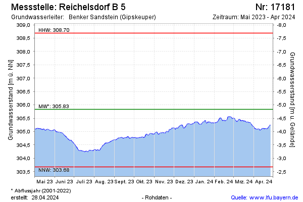
Current data Reichelsdorf B 5
Groundwater level [m above sealevel]: 304.82
Distance to surface [m]: -3.82
Last value from 14.07.2026 09:00
Ground level [m above sealevel]: 301.00
| Date | Groundwater level [m above sealevel] |
|---|---|
| 14.07.2026 | 304.83 |
| 13.07.2026 | 304.82 |
| 12.07.2026 | 304.81 |
| 11.07.2026 | 304.82 |
| 10.07.2026 | 304.83 |
| 09.07.2026 | 304.82 |
| 08.07.2026 | 304.82 |
| 07.07.2026 | 304.83 |