
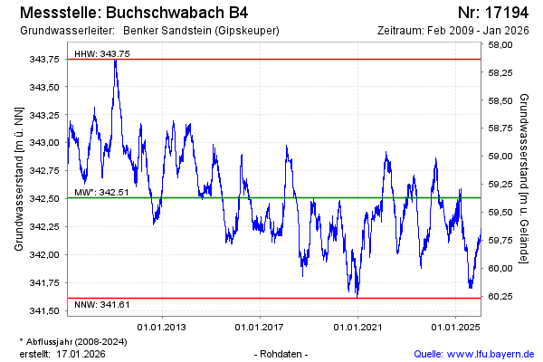
Chart of total period Buchschwabach B4
Groundwater level [m above sealevel]: 341,96
Distance to surface [m]: 59,92
Last value from 23.07.2026 10:00
Ground level [m above sealevel]: 401.88
| Date | Groundwater level [m above sealevel] |
|---|---|
| 23.07.2026 | 341.98 |
| 22.07.2026 | 341.98 |
| 21.07.2026 | 341.96 |
| 20.07.2026 | 341.95 |
| 19.07.2026 | 341.95 |
| 18.07.2026 | 341.95 |
| 17.07.2026 | 341.94 |
| 16.07.2026 | 341.91 |