
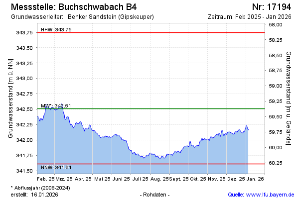
Current data Buchschwabach B4
Groundwater level [m above sealevel]: 341.86
Distance to surface [m]: 60.02
Last value from 13.07.2026 10:00
Ground level [m above sealevel]: 401.88
| Date | Groundwater level [m above sealevel] |
|---|---|
| 13.07.2026 | 341.88 |
| 12.07.2026 | 341.88 |
| 11.07.2026 | 341.89 |
| 10.07.2026 | 341.90 |
| 09.07.2026 | 341.91 |
| 08.07.2026 | 341.92 |
| 07.07.2026 | 341.95 |
| 06.07.2026 | 341.94 |