
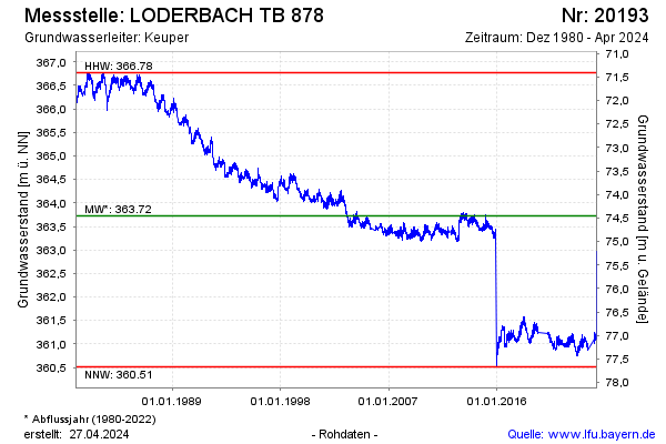
Chart of total period LODERBACH TB 878
Groundwater level [m above sealevel]: 362.47
Distance to surface [m]: 75.71
Last value from 13.07.2026 10:00
Ground level [m above sealevel]: 438.18
| Date | Groundwater level [m above sealevel] |
|---|---|
| 13.07.2026 | 362.49 |
| 12.07.2026 | 362.49 |
| 11.07.2026 | 362.50 |
| 10.07.2026 | 362.52 |
| 09.07.2026 | 362.52 |
| 08.07.2026 | 362.52 |
| 07.07.2026 | 362.53 |
| 06.07.2026 | 362.51 |