
Current data LODERBACH TB 878
Groundwater level [m above sealevel]: 362.55
Distance to surface [m]: 75.63
Last value from 24.06.2026 10:00
Ground level [m above sealevel]: 438.18
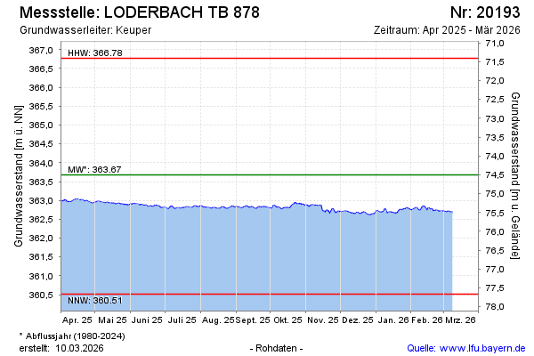
| Date | Groundwater level [m above sealevel] |
|---|---|
| 27.06.2026 | 362.53 |
| 26.06.2026 | 362.54 |
| 25.06.2026 | 362.55 |
| 24.06.2026 | 362.56 |
| 23.06.2026 | 362.56 |
| 22.06.2026 | 362.55 |
| 21.06.2026 | 362.55 |
| 20.06.2026 | 362.58 |