
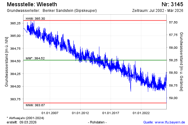
Chart of total period Wieseth
Groundwater level [m above sealevel]: 383,95
Distance to surface [m]: 58,82
Last value from 22.07.2026 13:00
Ground level [m above sealevel]: 442.77
| Date | Groundwater level [m above sealevel] |
|---|---|
| 22.07.2026 | 383.96 |
| 21.07.2026 | 383.96 |
| 20.07.2026 | 383.98 |
| 19.07.2026 | 384.00 |
| 18.07.2026 | 384.01 |
| 17.07.2026 | 384.01 |
| 16.07.2026 | 383.98 |
| 15.07.2026 | 383.98 |