
Current data Wieseth
Groundwater level [m above sealevel]: 383.94
Distance to surface [m]: 58.83
Last value from 24.06.2026 13:00
Ground level [m above sealevel]: 442.77
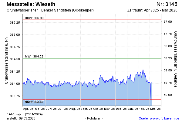
| Date | Groundwater level [m above sealevel] |
|---|---|
| 27.06.2026 | 383.96 |
| 26.06.2026 | 383.97 |
| 25.06.2026 | 383.97 |
| 24.06.2026 | 383.97 |
| 23.06.2026 | 383.96 |
| 22.06.2026 | 383.95 |
| 21.06.2026 | 383.94 |
| 20.06.2026 | 383.97 |