
- Start >
- Groundwater >
- Waterlevel of deep layer >
- Isar >
- Haslangkreit T6 >
- Current data

Current data Haslangkreit T6
Groundwater levels of the last 12 months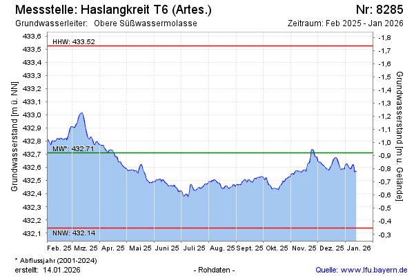
Groundwater level [m above sealevel]: 432.50
Distance to surface [m]: -0.71
Last value from 07.05.2024 10:00
Ground level [m above sealevel]: 431.79
| Date | Groundwater level [m above sealevel] |
|---|---|
| 06.05.2024 | 432.51 |
| 05.05.2024 | 432.51 |
| 04.05.2024 | 432.50 |
| 03.05.2024 | 432.51 |
| 02.05.2024 | 432.55 |
| 01.05.2024 | 432.55 |
| 30.04.2024 | 432.54 |
| 29.04.2024 | 432.54 |
© Bayerisches Landesamt für Umwelt 2024