
- Start >
- Groundwater >
- Waterlevel of deep layer >
- Isar >
- Haslangkreit T6 >
- Chart of total period

Chart of total period Haslangkreit T6
Groundwater levels of the total period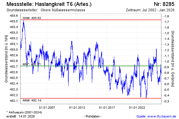
Groundwater level [m above sealevel]: 432.55
Distance to surface [m]: -0.76
Last value from 18.04.2024 10:00
Ground level [m above sealevel]: 431.79
| Date | Groundwater level [m above sealevel] |
|---|---|
| 17.04.2024 | 432.56 |
| 16.04.2024 | 432.56 |
| 15.04.2024 | 432.55 |
| 14.04.2024 | 432.53 |
| 13.04.2024 | 432.53 |
| 12.04.2024 | 432.53 |
| 11.04.2024 | 432.53 |
| 10.04.2024 | 432.56 |
© Bayerisches Landesamt für Umwelt 2024