
- Start >
- Groundwater >
- Waterlevel of deep layer >
- Inn >
- Postmünster T5 >
- Current data

Current data Postmünster T5
Groundwater levels of the last 12 months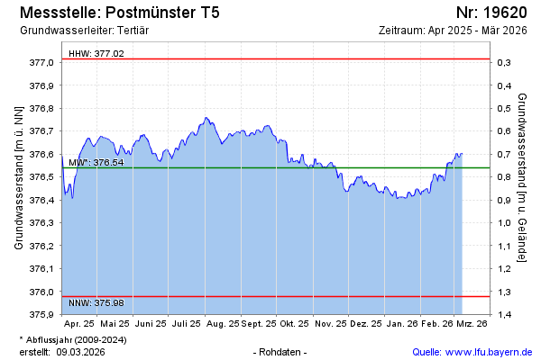
note
GW Messstelle im Grundnetz
Groundwater level [m above sealevel]: 376.70
Distance to surface [m]: 0.60
Last value from 09.05.2024 10:00
Ground level [m above sealevel]: 377.30
| Date | Groundwater level [m above sealevel] |
|---|---|
| 09.05.2024 | 376.71 |
| 08.05.2024 | 376.70 |
| 07.05.2024 | 376.71 |
| 06.05.2024 | 376.68 |
| 05.05.2024 | 376.67 |
| 04.05.2024 | 376.66 |
| 03.05.2024 | 376.66 |
| 02.05.2024 | 376.66 |
© Bayerisches Landesamt für Umwelt 2024