
- Start >
- Groundwater >
- Waterlevel of deep layer >
- Inn >
- Postmünster T5 >
- Current data

Current data Postmünster T5
Groundwater levels of the last 12 months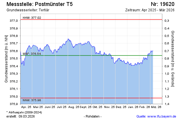
note
Messstelle ca. 3 Wochen außer Betrieb
Groundwater level [m above sealevel]: 376.46
Distance to surface [m]: 0.84
Last value from 03.05.2026 10:00
Ground level [m above sealevel]: 377.30
| Date | Groundwater level [m above sealevel] |
|---|---|
| 03.05.2026 | 376.47 |
| 02.05.2026 | 376.44 |
| 01.05.2026 | 376.42 |
| 30.04.2026 | 376.47 |
| 29.04.2026 | 376.54 |
| 28.04.2026 | 376.58 |
| 27.04.2026 | 376.58 |
| 26.04.2026 | 376.56 |
© Bayerisches Landesamt für Umwelt 2026