
- Start >
- Groundwater >
- Waterlevel of deep layer >
- Inn >
- BRUNNEN I FÜRSTBERG >
- Current data

Current data BRUNNEN I FÜRSTBERG
Groundwater levels of the last 12 months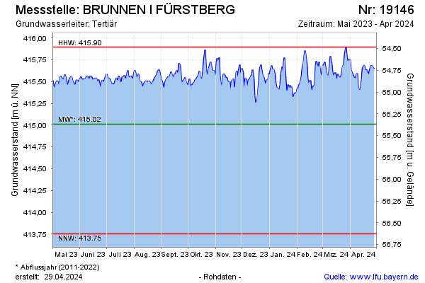
Groundwater level [m above sealevel]: 415.72
Distance to surface [m]: 54.66
Last value from 14.04.2026 08:00
Ground level [m above sealevel]: 470.38
| Date | Groundwater level [m above sealevel] |
|---|---|
| 14.04.2026 | 415.74 |
| 13.04.2026 | 415.77 |
| 12.04.2026 | 415.73 |
| 11.04.2026 | 415.70 |
| 10.04.2026 | 415.69 |
| 09.04.2026 | 415.65 |
| 08.04.2026 | 415.60 |
| 07.04.2026 | 415.61 |
© Bayerisches Landesamt für Umwelt 2026