
- Start >
- Groundwater >
- Waterlevel of deep layer >
- Inn >
- BRUNNEN I FÜRSTBERG >
- Chart of total period

Chart of total period BRUNNEN I FÜRSTBERG
Groundwater levels of the total period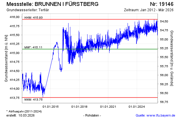
Groundwater level [m above sealevel]: 415.69
Distance to surface [m]: 54.69
Last value from 17.04.2024 08:00
Ground level [m above sealevel]: 470.38
| Date | Groundwater level [m above sealevel] |
|---|---|
| 18.04.2024 | 415.66 |
| 17.04.2024 | 415.69 |
| 16.04.2024 | 415.69 |
| 15.04.2024 | 415.64 |
| 14.04.2024 | 415.53 |
| 13.04.2024 | 415.45 |
| 12.04.2024 | 415.41 |
| 11.04.2024 | 415.41 |
© Bayerisches Landesamt für Umwelt 2024