
- Start >
- Groundwater >
- Waterlevel of deep layer >
- Iller - Lech - Bodensee >
- Roggenburg T 13 >
- Chart of total period

Chart of total period Roggenburg T 13
Groundwater levels of the total period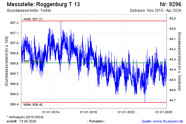
Groundwater level [m above sealevel]: 506.72
Distance to surface [m]: 44.42
Last value from 23.05.2024 11:00
Ground level [m above sealevel]: 551.14
| Date | Groundwater level [m above sealevel] |
|---|---|
| 22.05.2024 | 506.76 |
| 21.05.2024 | 506.79 |
| 20.05.2024 | 506.76 |
| 19.05.2024 | 506.75 |
| 18.05.2024 | 506.76 |
| 17.05.2024 | 506.80 |
| 16.05.2024 | 506.80 |
| 15.05.2024 | 506.81 |
© Bayerisches Landesamt für Umwelt 2024