
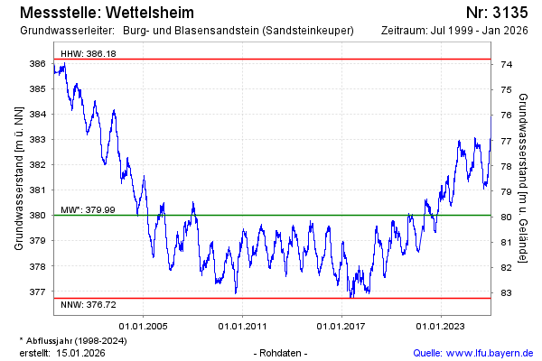
Chart of total period Wettelsheim
Groundwater level [m above sealevel]: 381.45
Distance to surface [m]: 78.5
Last value from 12.07.2026 13:00
Ground level [m above sealevel]: 459.95
| Date | Groundwater level [m above sealevel] |
|---|---|
| 12.07.2026 | 381.47 |
| 11.07.2026 | 381.53 |
| 10.07.2026 | 381.58 |
| 09.07.2026 | 381.61 |
| 08.07.2026 | 381.64 |
| 07.07.2026 | 381.68 |
| 06.07.2026 | 381.66 |
| 05.07.2026 | 381.69 |