
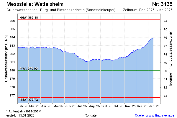
Current data Wettelsheim
Groundwater level [m above sealevel]: 381.84
Distance to surface [m]: 78.11
Last value from 30.06.2026 13:00
Ground level [m above sealevel]: 459.95
| Date | Groundwater level [m above sealevel] |
|---|---|
| 30.06.2026 | 381.86 |
| 29.06.2026 | 381.86 |
| 28.06.2026 | 381.87 |
| 27.06.2026 | 381.89 |
| 26.06.2026 | 381.92 |
| 25.06.2026 | 381.97 |
| 24.06.2026 | 382.01 |
| 23.06.2026 | 382.04 |