
- Start >
- Groundwater >
- Waterlevel of deep layer >
- Bayern >
- Unterwittbach S 1 >
- Year chart of precipitation

Year chart of precipitation Unterwittbach S 1
Groundwater levels of the last 12 months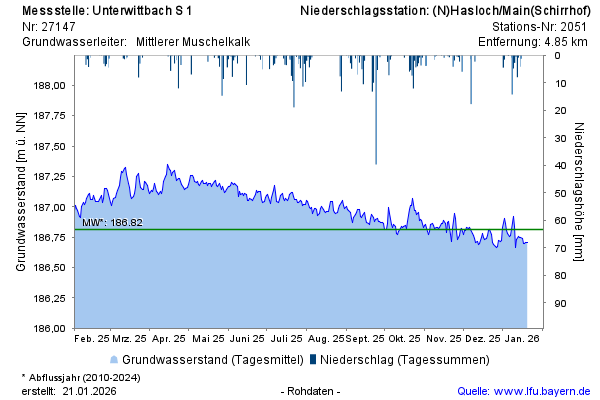
Groundwater level [m above sealevel]: 186,88
Distance to surface [m]: 63,50
Last value from 20.05.2026 09:00
Ground level [m above sealevel]: 250.38
© Bayerisches Landesamt für Umwelt 2026