
- Start >
- Groundwater >
- Waterlevel of deep layer >
- Bayern >
- Tiefenried GS1 >
- Chart of total period

Chart of total period Tiefenried GS1
Groundwater levels of the total period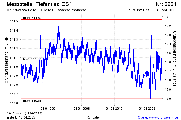
note
Störung der Messeinrichtung: Messwerte ab Sept. 2022 unsicher!
Groundwater level [m above sealevel]: 510.97
Distance to surface [m]: 15.68
Last value from 13.04.2026 09:00
Ground level [m above sealevel]: 526.65
| Date | Groundwater level [m above sealevel] |
|---|---|
| 13.04.2026 | 510.97 |
| 12.04.2026 | 510.95 |
| 11.04.2026 | 510.95 |
| 10.04.2026 | 510.94 |
| 09.04.2026 | 510.94 |
| 08.04.2026 | 510.92 |
| 07.04.2026 | 510.93 |
| 06.04.2026 | 510.92 |
© Bayerisches Landesamt für Umwelt 2026