
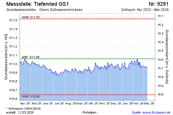
Current data Tiefenried GS1
note
Störung der Messeinrichtung, vorübergehend offline.
Groundwater level [m above sealevel]: 510.75
Distance to surface [m]: 15.9
Last value from 09.07.2026 14:09
Ground level [m above sealevel]: 526.65
| Date | Groundwater level [m above sealevel] |
|---|---|
| 09.07.2026 | 510.40 |
| 08.07.2026 | 510.75 |
| 07.07.2026 | 510.76 |
| 06.07.2026 | 510.75 |
| 05.07.2026 | 510.74 |
| 04.07.2026 | 510.74 |
| 03.07.2026 | 510.69 |
| 02.07.2026 | 509.00 |