
- Start >
- Groundwater >
- Waterlevel of deep layer >
- Bayern >
- Schleerieth MU2 >
- Chart of total period

Chart of total period Schleerieth MU2
Groundwater levels of the total period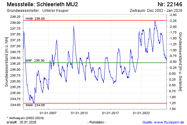
note
Arteser
Groundwater level [m above sealevel]: 237.15
Distance to surface [m]: -1.32
Last value from 12.03.2026 10:00
Ground level [m above sealevel]: 235.83
| Date | Groundwater level [m above sealevel] |
|---|---|
| 10.03.2026 | 237.16 |
| 09.03.2026 | 237.15 |
| 08.03.2026 | 237.15 |
| 07.03.2026 | 237.15 |
| 06.03.2026 | 237.15 |
| 05.03.2026 | 237.15 |
| 04.03.2026 | 237.14 |
| 03.03.2026 | 237.14 |
© Bayerisches Landesamt für Umwelt 2026