
- Start >
- Groundwater >
- Waterlevel of deep layer >
- Bayern >
- Schleerieth MU2 >
- Current data

Current data Schleerieth MU2
Groundwater levels of the last 12 months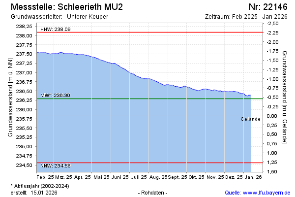
note
Arteser
Groundwater level [m above sealevel]: 236.80
Distance to surface [m]: -0.97
Last value from 29.05.2026 10:00
Ground level [m above sealevel]: 235.83
| Date | Groundwater level [m above sealevel] |
|---|---|
| 29.05.2026 | 236.82 |
| 28.05.2026 | 236.82 |
| 27.05.2026 | 236.83 |
| 26.05.2026 | 236.83 |
| 25.05.2026 | 236.84 |
| 24.05.2026 | 236.85 |
| 23.05.2026 | 236.86 |
| 22.05.2026 | 236.87 |
© Bayerisches Landesamt für Umwelt 2026