
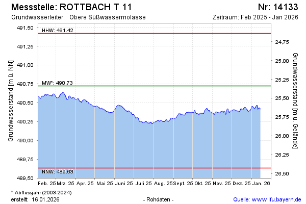
Current data ROTTBACH T 11
Groundwater level [m above sealevel]: 489,88
Distance to surface [m]: 26,18
Last value from 23.07.2026 09:00
Ground level [m above sealevel]: 516.06
| Date | Groundwater level [m above sealevel] |
|---|---|
| 23.07.2026 | 489.88 |
| 22.07.2026 | 489.88 |
| 21.07.2026 | 489.88 |
| 20.07.2026 | 489.89 |
| 19.07.2026 | 489.90 |
| 18.07.2026 | 489.90 |
| 17.07.2026 | 489.90 |
| 16.07.2026 | 489.90 |