
- Start >
- Groundwater >
- Waterlevel of deep layer >
- Bayern >
- ROTHOF (WÜ-MU 8) >
- Current data

Current data ROTHOF (WÜ-MU 8)
Groundwater levels of the last 12 months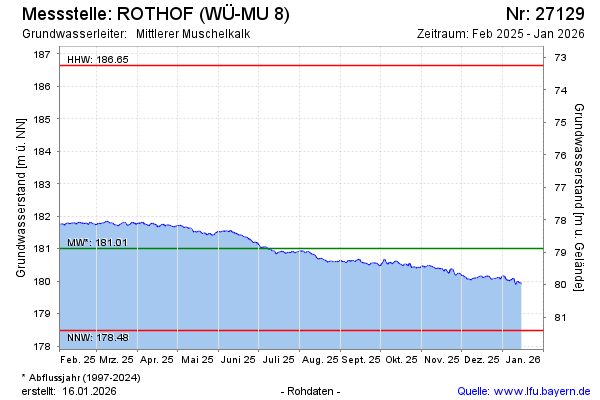
Groundwater level [m above sealevel]: 182.42
Distance to surface [m]: 77.47
Last value from 01.05.2024 10:00
Ground level [m above sealevel]: 259.89
| Date | Groundwater level [m above sealevel] |
|---|---|
| 01.05.2024 | 182.41 |
| 30.04.2024 | 182.38 |
| 29.04.2024 | 182.34 |
| 28.04.2024 | 182.38 |
| 27.04.2024 | 182.40 |
| 26.04.2024 | 182.42 |
| 25.04.2024 | 182.43 |
| 24.04.2024 | 182.44 |
© Bayerisches Landesamt für Umwelt 2024