
- Start >
- Groundwater >
- Waterlevel of deep layer >
- Bayern >
- ROTHOF (WÜ-MU 8) >
- Chart of total period

Chart of total period ROTHOF (WÜ-MU 8)
Groundwater levels of the total period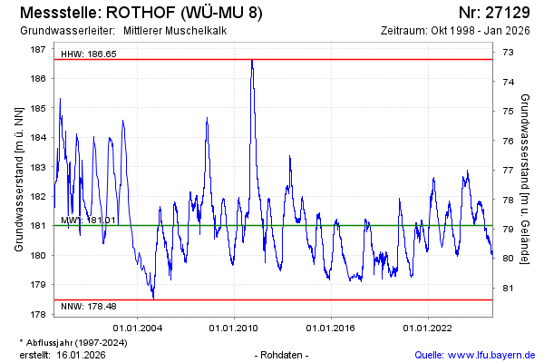
Groundwater level [m above sealevel]: 180.05
Distance to surface [m]: 79.84
Last value from 05.12.2025 10:00
Ground level [m above sealevel]: 259.89
| Date | Groundwater level [m above sealevel] |
|---|---|
| 05.12.2025 | 180.08 |
| 04.12.2025 | 180.11 |
| 03.12.2025 | 180.12 |
| 02.12.2025 | 180.17 |
| 01.12.2025 | 180.16 |
| 30.11.2025 | 180.21 |
| 29.11.2025 | 180.23 |
| 28.11.2025 | 180.22 |
© Bayerisches Landesamt für Umwelt 2025