
- Start >
- Groundwater >
- Waterlevel of deep layer >
- Bayern >
- MITTERFECKING W2 >
- Chart of total period

Chart of total period MITTERFECKING W2
Groundwater levels of the total period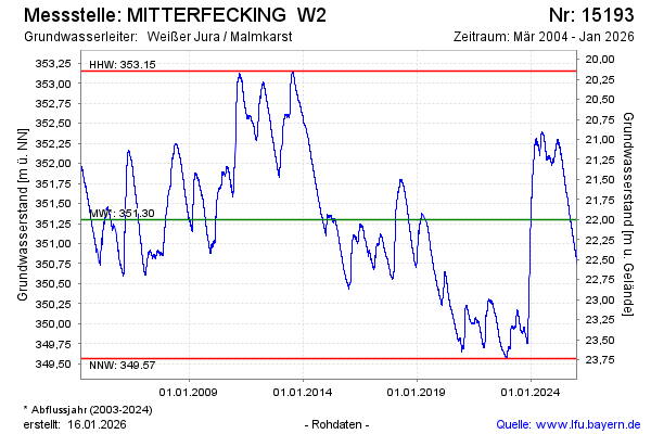
Groundwater level [m above sealevel]: 350.82
Distance to surface [m]: 22.48
Last value from 02.05.2026 10:00
Ground level [m above sealevel]: 373.30
| Date | Groundwater level [m above sealevel] |
|---|---|
| 02.05.2026 | 350.83 |
| 01.05.2026 | 350.83 |
| 30.04.2026 | 350.84 |
| 29.04.2026 | 350.85 |
| 28.04.2026 | 350.86 |
| 27.04.2026 | 350.86 |
| 26.04.2026 | 350.86 |
| 25.04.2026 | 350.87 |
© Bayerisches Landesamt für Umwelt 2026