
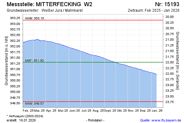
Current data MITTERFECKING W2
Groundwater level [m above sealevel]: 350.40
Distance to surface [m]: 22.9
Last value from 14.07.2026 10:00
Ground level [m above sealevel]: 373.30
| Date | Groundwater level [m above sealevel] |
|---|---|
| 14.07.2026 | 350.42 |
| 13.07.2026 | 350.42 |
| 12.07.2026 | 350.42 |
| 11.07.2026 | 350.43 |
| 10.07.2026 | 350.44 |
| 09.07.2026 | 350.44 |
| 08.07.2026 | 350.45 |
| 07.07.2026 | 350.45 |