
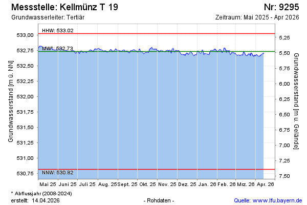
Current data Kellmünz T 19
Groundwater level [m above sealevel]: 532.61
Distance to surface [m]: 5.6
Last value from 01.07.2026 08:00
Ground level [m above sealevel]: 538.21
| Date | Groundwater level [m above sealevel] |
|---|---|
| 01.07.2026 | 532.61 |
| 30.06.2026 | 532.60 |
| 29.06.2026 | 532.59 |
| 28.06.2026 | 532.60 |
| 27.06.2026 | 532.60 |
| 26.06.2026 | 532.61 |
| 25.06.2026 | 532.61 |
| 24.06.2026 | 532.61 |