
- Start >
- Groundwater >
- Waterlevel of deep layer >
- Bayern >
- Fürth-Unterfürberg B2 >
- Current data

Current data Fürth-Unterfürberg B2
Groundwater levels of the last 12 months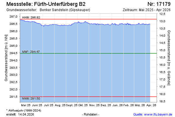
Groundwater level [m above sealevel]: 296.46
Distance to surface [m]: 13.23
Last value from 09.05.2024 10:00
Ground level [m above sealevel]: 309.69
| Date | Groundwater level [m above sealevel] |
|---|---|
| 09.05.2024 | 296.49 |
| 08.05.2024 | 296.49 |
| 07.05.2024 | 296.53 |
| 06.05.2024 | 296.56 |
| 05.05.2024 | 296.54 |
| 04.05.2024 | 296.53 |
| 03.05.2024 | 296.54 |
| 02.05.2024 | 296.59 |
© Bayerisches Landesamt für Umwelt 2024