
- Start >
- Groundwater >
- Waterlevel of deep layer >
- Bayern >
- Fürth-Unterfürberg B2 >
- Chart of total period

Chart of total period Fürth-Unterfürberg B2
Groundwater levels of the total period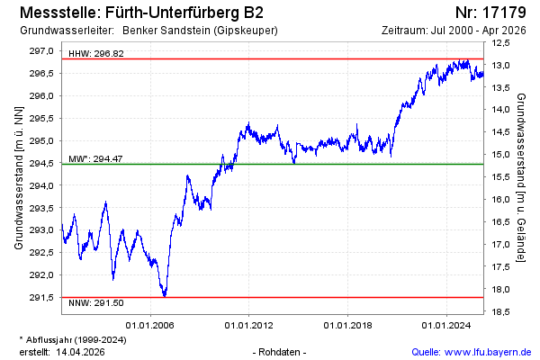
Groundwater level [m above sealevel]: 296.49
Distance to surface [m]: 13.20
Last value from 23.01.2026 10:00
Ground level [m above sealevel]: 309.69
| Date | Groundwater level [m above sealevel] |
|---|---|
| 23.01.2026 | 296.49 |
| 22.01.2026 | 296.49 |
| 21.01.2026 | 296.46 |
| 20.01.2026 | 296.42 |
| 19.01.2026 | 296.41 |
| 18.01.2026 | 296.40 |
| 17.01.2026 | 296.41 |
| 16.01.2026 | 296.42 |
© Bayerisches Landesamt für Umwelt 2026