
- Start >
- Groundwater >
- Waterlevel of deep layer >
- Bayern >
- Eschenried T 17f >
- Chart of total period

Chart of total period Eschenried T 17f
Groundwater levels of the total period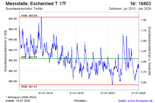
Groundwater level [m above sealevel]: 492.24
Distance to surface [m]: 2.69
Last value from 22.05.2024 10:00
Ground level [m above sealevel]: 494.93
| Date | Groundwater level [m above sealevel] |
|---|---|
| 21.05.2024 | 492.25 |
| 20.05.2024 | 492.25 |
| 19.05.2024 | 492.25 |
| 18.05.2024 | 492.25 |
| 17.05.2024 | 492.26 |
| 16.05.2024 | 492.28 |
| 15.05.2024 | 492.28 |
| 14.05.2024 | 492.29 |
© Bayerisches Landesamt für Umwelt 2024