
- Startseite >
- Flüsse >
- Wasserstand >
- Bayern >
- Untersteinach >
- Jahresgrafik

Jahresgrafik Untersteinach / Schorgast
Wasserstand vom 01.01.2023 bis zum 31.12.2023
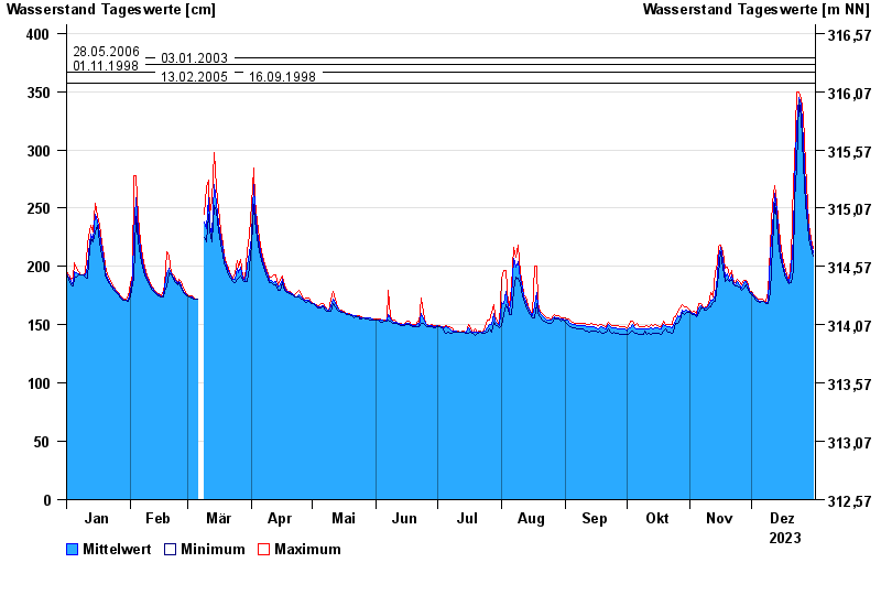
- 28.05.2006 Wasserstand: 379 cm
- 03.01.2003 Wasserstand: 373 cm
- 01.11.1998 Wasserstand: 367 cm
- 13.02.2005 Wasserstand: 357 cm
- 16.09.1998 Wasserstand: 357 cm
| Datum | Mittelwert [cm] | Maximum [cm] | Minimum [cm] |
|---|---|---|---|
| 31.12.2023 | 212 | 215 | 209 |
| 30.12.2023 | 220 | 224 | 215 |
| 29.12.2023 | 230 | 236 | 224 |
| 28.12.2023 | 243 | 253 | 236 |
| 27.12.2023 | 267 | 287 | 253 |
| 26.12.2023 | 307 | 329 | 287 |
| 25.12.2023 | 339 | 344 | 329 |
© Bayerisches Landesamt für Umwelt 2025