
- Startseite >
- Flüsse >
- Wasserstand >
- Bayern >
- Untersteinach >
- Jahresgrafik

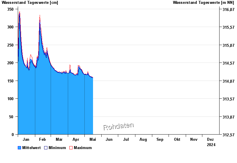
Jahresgrafik Untersteinach / Schorgast
Wasserstand vom 01.01.2024 bis zum 31.12.2024
- 28.05.2006 Wasserstand: 379 cm
- 03.01.2003 Wasserstand: 373 cm
- 01.11.1998 Wasserstand: 367 cm
- 13.02.2005 Wasserstand: 357 cm
- 16.09.1998 Wasserstand: 357 cm
| Datum | Mittelwert [cm] | Maximum [cm] | Minimum [cm] |
|---|---|---|---|
| 31.12.2024 | 179 | 181 | 178 |
| 30.12.2024 | 182 | 183 | 180 |
| 29.12.2024 | 184 | 185 | 183 |
| 28.12.2024 | 187 | 189 | 185 |
| 27.12.2024 | 191 | 193 | 189 |
| 26.12.2024 | 196 | 199 | 193 |
| 25.12.2024 | 202 | 206 | 199 |
© Bayerisches Landesamt für Umwelt 2025