
- Start >
- Rivers >
- Watertemperature >
- Bayern >
- Grafenmühle >
- Master data

Master data Grafenmühle
Site number: 17207508
Community: Vilshofen an der Donau
District: Passau
Operator:  Wasserwirtschaftsamt Deggendorf
Body of water: Vils
Easting: 805522 (ETRS89 / UTM Zone 32N)
Northing: 5392491
Ground level: 308.00 m above sealevel
Observed since: 1980
Maximum watertemperature since 1980: 28.1 °C
Mean watertemperature since 1980: 11 °C
Minimum watertemperature since 1980: -1.4 °C
Picture of the measurement site
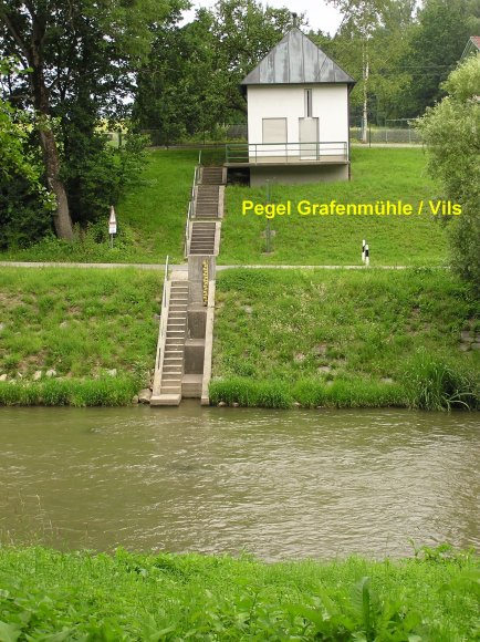
Location of the station Grafenmühle / Vils
| Measurement site | Category |
|---|---|
 Hofkirchen Hofkirchen | Rivers: Runoff, Waterlevel |
| Deggendorf | Rivers: Runoff, Waterlevel |
| Auerbach | Rivers: Runoff, Waterlevel |
| Grafenmühle | Rivers: Runoff, Waterlevel, Water temperature, Water temperature |
© Bayerisches Landesamt für Umwelt 2026