
- Start >
- Rivers >
- Waterlevel >
- Regnitz >
- Unterwurmbach >
- Chart of total period

Chart of total period Unterwurmbach / Wurmbach
Waterlevel from 24.02.1986 to 26.04.2024
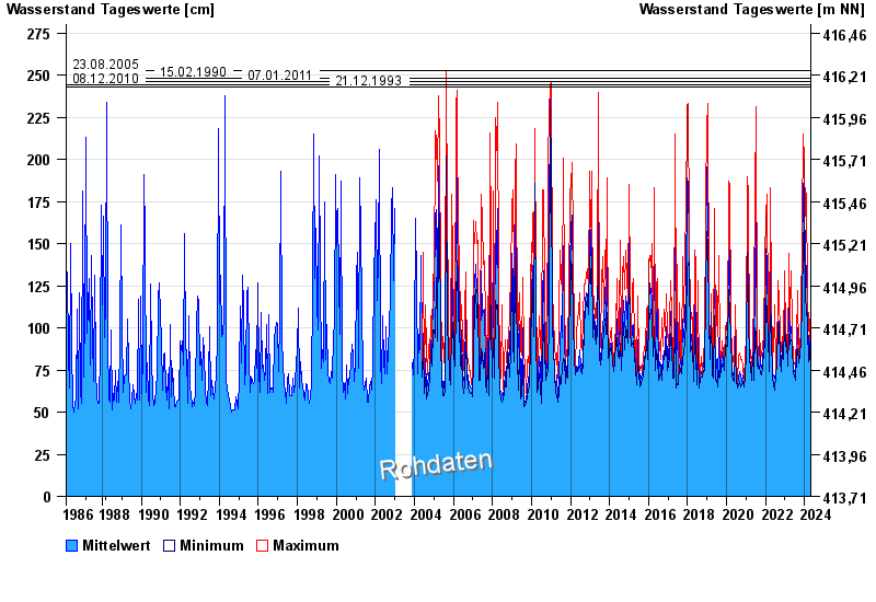
- 23.08.2005 Wasserstand: 253 cm
- 15.02.1990 Wasserstand: 248 cm
- 07.01.2011 Wasserstand: 246 cm
- 08.12.2010 Wasserstand: 244 cm
- 21.12.1993 Wasserstand: 243 cm
| Date | Mean value [cm] | Maximum [cm] | Minimum [cm] |
|---|---|---|---|
| 26.04.2024 | 73 | 73 | 72 |
| 25.04.2024 | 72 | 74 | 71 |
| 24.04.2024 | 72 | 73 | 71 |
| 23.04.2024 | 73 | 73 | 72 |
| 22.04.2024 | 74 | 75 | 73 |
| 21.04.2024 | 75 | 78 | 73 |
| 20.04.2024 | 75 | 78 | 74 |
© Bayerisches Landesamt für Umwelt 2024