
- Start >
- Rivers >
- Waterlevel >
- Regnitz >
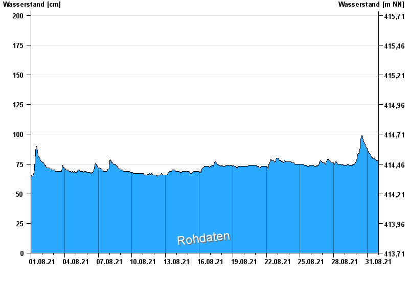
- Unterwurmbach >
- Chart of month

Chart of month Unterwurmbach / Wurmbach
Waterlevel from 01.08.2021 to 31.08.2021
- 23.08.2005 Wasserstand: 253 cm
- 15.02.1990 Wasserstand: 248 cm
- 07.01.2011 Wasserstand: 246 cm
- 08.12.2010 Wasserstand: 244 cm
- 21.12.1993 Wasserstand: 243 cm
| Date | Waterlevel [cm] |
|---|---|
| 01.09.2021 00:45 | 77 |
| 01.09.2021 00:30 | 77 |
| 01.09.2021 00:15 | 78 |
| 01.09.2021 00:00 | 78 |
| 31.08.2021 23:45 | 78 |
| 31.08.2021 23:30 | 78 |
| 31.08.2021 23:15 | 78 |
© Bayerisches Landesamt für Umwelt 2024