
- Start >
- Rivers >
- Waterlevel >
- Regnitz >
- Unterleinleiter >
- Chart of month

Chart of month Unterleinleiter / Leinleiterbach
Waterlevel from 01.06.2021 to 30.06.2021
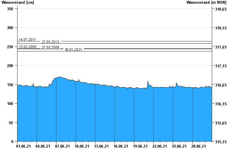
- 14.01.2011 Wasserstand: 264 cm
- 27.05.2013 Wasserstand: 258 cm
- 13.02.2005 Wasserstand: 245 cm
- 27.03.2006 Wasserstand: 244 cm
- 30.01.2021 Wasserstand: 238 cm
| Date | Waterlevel [cm] |
|---|---|
| 01.07.2021 00:45 | 143 |
| 01.07.2021 00:30 | 143 |
| 01.07.2021 00:15 | 143 |
| 01.07.2021 00:00 | 143 |
| 30.06.2021 23:45 | 143 |
| 30.06.2021 23:30 | 143 |
| 30.06.2021 23:15 | 143 |
© Bayerisches Landesamt für Umwelt 2024