
- Start >
- Rivers >
- Waterlevel >
- Regnitz >
- Staudach >
- Chart of year

Chart of year Staudach / Tiroler Achen
Waterlevel from 22.05.2022 to 21.05.2023
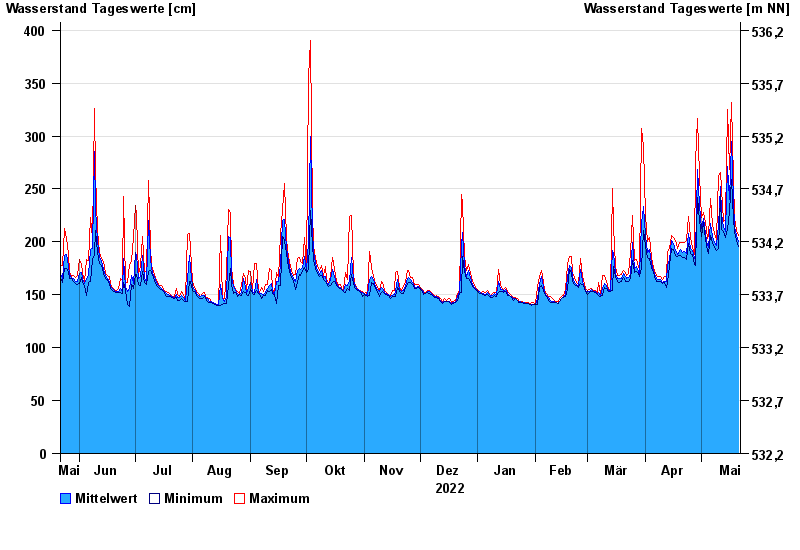
| Date | Mean value [cm] | Maximum [cm] | Minimum [cm] |
|---|---|---|---|
| 21.05.2023 | 200 | 206 | 196 |
| 20.05.2023 | 206 | 211 | 201 |
| 19.05.2023 | 214 | 222 | 209 |
| 18.05.2023 | 238 | 259 | 222 |
| 17.05.2023 | 295 | 332 | 259 |
| 16.05.2023 | 240 | 268 | 229 |
| 15.05.2023 | 271 | 325 | 212 |
© Bayerisches Landesamt für Umwelt 2024