
- Start >
- Rivers >
- Waterlevel >
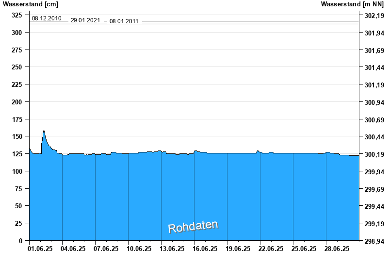
- Regnitz >
- Scheinfeld >
- Chart of month

Chart of month Scheinfeld / Scheine
Waterlevel from 01.06.2025 to 30.06.2025
note
Datenübertragung Geber 1 fällt zeitweise aus.
- 09.07.2021 Wasserstand: 353 cm
- 31.05.2013 Wasserstand: 335 cm
- 08.12.2010 Wasserstand: 316 cm
- 29.01.2021 Wasserstand: 313 cm
- 08.01.2011 Wasserstand: 312 cm
| Date | Waterlevel [cm] |
|---|---|
| 01.07.2025 00:45 | 122 |
| 01.07.2025 00:30 | 122 |
| 01.07.2025 00:15 | 122 |
| 01.07.2025 00:00 | 122 |
| 30.06.2025 23:45 | 122 |
| 30.06.2025 23:30 | 122 |
| 30.06.2025 23:15 | 122 |
© Bayerisches Landesamt für Umwelt 2025