
- Start >
- Rivers >
- Waterlevel >
- Regnitz >
- Reupelsdorf >
- Chart of month

Chart of month Reupelsdorf / Schwarzach
Waterlevel from 01.04.2024 to 28.04.2024
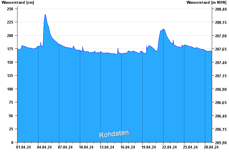
- Hochwassergefahrenfläche HQ100 380 cm
| Date | Waterlevel [cm] |
|---|---|
| 28.04.2024 13:30 | 171 |
| 28.04.2024 13:15 | 171 |
| 28.04.2024 13:00 | 171 |
| 28.04.2024 12:45 | 171 |
| 28.04.2024 12:30 | 171 |
| 28.04.2024 12:15 | 170 |
| 28.04.2024 12:00 | 170 |
© Bayerisches Landesamt für Umwelt 2024