
- Start >
- Rivers >
- Waterlevel >
- Regnitz >
- Rappoldshofen >
- Chart of year

Chart of year Rappoldshofen / Aisch
Waterlevel from 28.04.2024 to 27.04.2025
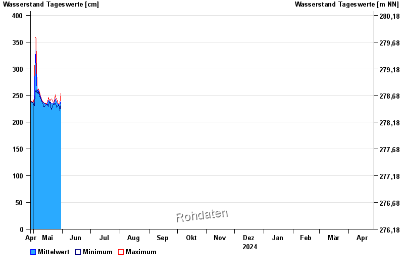
| Date | Mean value [cm] | Maximum [cm] | Minimum [cm] |
|---|---|---|---|
| 08.05.2024 | 249 | 251 | 247 |
| 07.05.2024 | 255 | 259 | 251 |
| 06.05.2024 | 261 | 263 | 258 |
| 05.05.2024 | 257 | 261 | 253 |
| 04.05.2024 | 301 | 357 | 261 |
| 03.05.2024 | 335 | 359 | 255 |
| 02.05.2024 | 236 | 253 | 231 |
© Bayerisches Landesamt für Umwelt 2024