
- Start >
- Rivers >
- Waterlevel >
- Regnitz >
- Rappoldshofen >
- Chart of year

Chart of year Rappoldshofen / Aisch
Waterlevel from 01.01.2022 to 31.12.2022
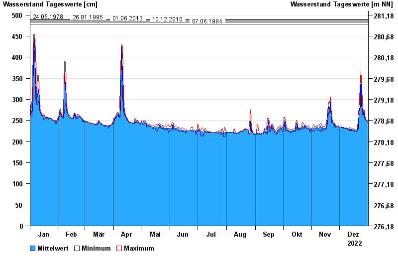
- 24.05.1978 Wasserstand: 489 cm
- 26.01.1995 Wasserstand: 488 cm
- 01.06.2013 Wasserstand: 485 cm
- 10.12.2010 Wasserstand: 483 cm
- 07.06.1984 Wasserstand: 478 cm
| Date | Mean value [cm] | Maximum [cm] | Minimum [cm] |
|---|---|---|---|
| 31.12.2022 | 248 | 249 | 246 |
| 30.12.2022 | 250 | 252 | 249 |
| 29.12.2022 | 252 | 253 | 252 |
| 28.12.2022 | 259 | 266 | 252 |
| 27.12.2022 | 272 | 277 | 266 |
| 26.12.2022 | 263 | 269 | 261 |
| 25.12.2022 | 286 | 324 | 269 |
© Bayerisches Landesamt für Umwelt 2024